Project created : 2017-12-25 13:39:35
Project updated : 2018-02-22 13:30:46
Views : 5069
Smart Ring Road
Egypt, Cairo - Transport
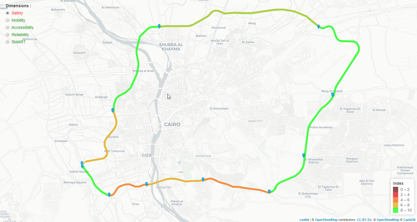
This study aims to harness the power of data to assess the levels of Safety, Mobility, Accessibility and Reliability of Transport on Cairo’s urban roads. This is accomplished using simple and affordable digital technologies, while capitalizing on open-sourced, crowd-sourced, and existing government data. To best study the above prolonged dimensions (SMART, for short) the research team identified the heaviest travelled roadway in the region, the Ring Road (RR), encompassing the region’s largest metropolis, Greater Cairo- as a case study to report on the potential of data and digital technologies in furthering efforts of evidence-based planning in the Egyptian transportation sector.
Project dataset
Rows : 20 , Columns : 5
| Name | Type | Length |
|---|---|---|
| Road | String | 35 |
| Safety (S) | Numeric | 3 |
| Mobility (M) | Numeric | 3 |
| Accessibility (A) | Numeric | 3 |
| Reliability of Transport (RT) | Numeric | 3 |
Dataset file : smartforda2ery.csv (216 KB)
Additional files : smartforda2ery.json (315 KB)
| Road | Safety (S) | Mobility (M) | Accessibility (A) | Reliability of Transport (RT) |
|---|